• <1 minute

Geospatial imagery unlocks new cloud computing scenarios on Azure

In the year since Azure Space was announced, Microsoft has focused on extending its Azure Space ecosystem by partnering with industry leaders in the space community to empower customers and partners to achieve more. Today, Microsoft is expanding on its mission to make Azure Space the platform and ecosystem of choice for the space community through a new partnership with Airbus and the general availability of their premium satellite imagery and elevation data in Microsoft’s Azure Maps.

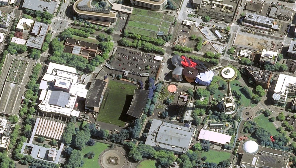
An aerial view of a sports stadium.

Pléiades Neo © Airbus DS 2021

In the year since Azure Space was announced, Microsoft has focused on extending its Azure Space ecosystem by partnering with industry leaders in the space community to empower customers and partners to achieve more.

Today, Microsoft is expanding on its mission to make Azure Space the platform and ecosystem of choice for the space community through a new partnership with Airbus and the general availability of their premium satellite imagery and elevation data in Microsoft’s Azure Maps. Through this partnership, Airbus will feed Azure Maps with its SPOT (1.5m resolution), Pléiades (50cm), and Pléiades Neo (30cm) satellite imagery and WorldDEM4Ortho elevation data. WorldDEM4Ortho is based on the global WorldDEM elevation dataset and has a resolution of 24m with a vertical accuracy of 4m.

“We are thrilled to be a part of the Microsoft Azure community,” said François Lombard, Director of the Intelligence Business at Airbus Defense and Space. “Azure Maps users, eager for accurate and top-quality imagery, will be able to rely on Airbus’ premium data services to develop new applications and turn their innovative ideas into reality.”

Together, Microsoft and Airbus can unlock new cloud computing scenarios and equip organizations around the globe with insights that can enable innovative solutions to complex and time-consuming questions, such as the following.

Empowering a more predictable supply chain

Global supply chains and businesses all around the world have been faced with unprecedented disruptions due to major spikes in consumer demand, product shortages, and traffic congestion. Airbus imagery combined with Azure Machine Learning and AI can help organizations predict a disruption before it happens by analyzing shipping routes, traffic patterns, and global consumer buying trends.

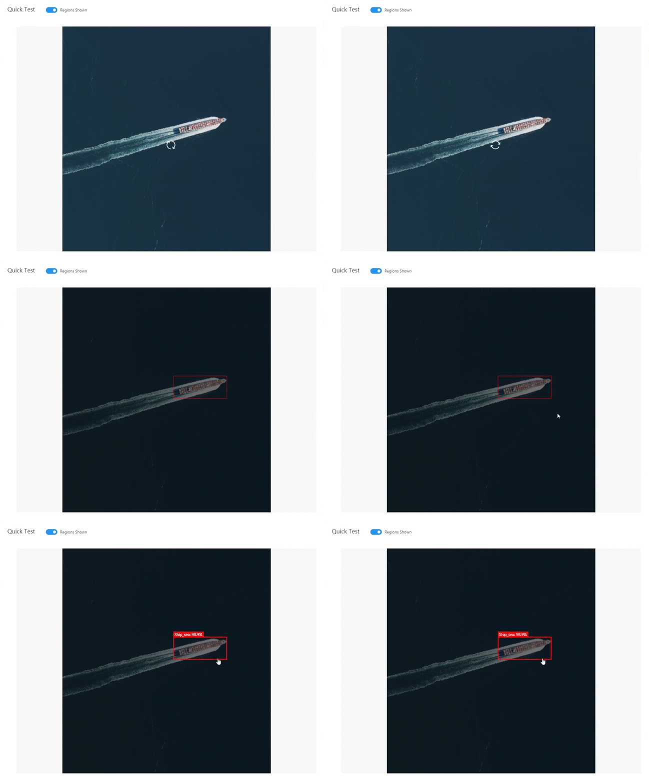
Azure Cognitive Services, like Custom Vision, allow organizations to develop and deploy machine learning models on satellite imagery to help better understand global shipping patterns by identifying the location and quantity of cargo ships waiting to be unloaded at ports.

Azure Cognitive Services using a Machine Learning Model to detect a ship on a satellite image of a port.

Azure Cognitive Services using a Machine Learning Model to detect a ship on a satellite image of a port.

The insights derived from satellite imagery can then go into tools such as Microsoft Power BI and be combined with other data streams to provide analytics to drive decision-making. Check out the Azure ship detection GitHub.

Connecting first responders with the quickest and safest routes to protect those at most risk

Airbus imagery and the combination of Azure can help identify conditions that are hazardous for fires before they occur and help prevent the impact to homes and lives that are at most risk. This technology can serve as another set of eyes for first responders on the ground by connecting them with the freshest data powered by space.

Using Azure Space and Earth Observation Imagery to restore the loss of wetlands

Combining the power of Azure with Airbus satellite imagery ranging from 30cm to more than 20m, we can create a mapping of inventory to identify wetlands at risk of carbon fixation, decomposition, and sequestration. This data can help scientists, international and local agencies, and ecological researchers understand how wetlands are changing over time and better monitor, assess, and help restore the loss of these complex ecosystems.

Learn more

“Microsoft Azure, combined with the power of Airbus’ high-quality imagery, allows customers to develop new solutions to their problems through premium satellite imagery and data services. This partnership will empower our customers globally and provide a path to addressing complex questions,” said Steve Kitay, Senior Director of Azure Space at Microsoft. “We’re excited to be working with Airbus to help customers inform business outcomes and drive critical mission decisions.”

By partnering with industry leaders like Airbus, we can extend the utility of our Azure capabilities and transform our understanding of the world and connect people from across the globe to solve business and societal challenges.
Learn more about Azure Space.