Today we announced the Public Preview availability of Azure Location Based Services (LBS). LBS is a portfolio of geospatial service APIs natively integrated into Azure that enable developers, enterprises and ISVs to create location aware apps and IoT, mobility, logistics and asset tracking solutions. The portfolio currently comprises of services for Map Rendering, Routing, Search, Time Zones and Traffic. In partnership with TomTom and in support of our enterprise customers, Microsoft has added native location capabilities to the Azure public cloud.
Azure LBS has a robust set of geospatial services atop a global geographic data set. These services are comprised of 5 primary REST services and a JavaScript Map Control. Each service has a unique set of capabilities atop of the base map data and are built in unison and in accordance with Azure standards making it easy to work interoperable between the services. Additionally, Azure LBS is fully hosted and integrated into the Azure cloud meaning the services are compliant with all Azure fundamentals for privacy, usability, global readiness, accessibility and localization. Users can manage all Azure LBS account information from within the Azure portal and billed like any other Azure service.
Azure LBS uses key-based authentication. To get a key, go to the Azure portal and create and Azure LBS account. By creating an Azure LBS account, you automatically generate two Azure LBS keys. Both keys will authenticate requests to the various Azure LBS services. Once you have your account and your keys, you’re ready to start accessing Azure Location Based Services. And, the API model is simple to use. Simply parameterize your URL request to get rich responses from the service:
Sample Address Search Request (Key Required): atlas.microsoft.com/search/address/json?api-version=1&query=1 Microsoft Way, Redmond, WA
Azure LBS enters public preview with five distinct services. Render (for maps), Route (for directions), Search, Time Zones and Traffic and a JavaScript Map Control. Each of these services are described in more detail below.
Azure Map Control
The Azure Map Control is a JavaScript web control with built-in capabilities for fetching Azure LBS vector map tiles, drawing data atop of it and interacting with the map canvas. The Azure Map Control allows developers to layer their data atop of Azure LBS Maps in both vector and raster layers meaning if enterprise customers have coordinates for points, lines and polygons or if they have geo-annotated maps of a manufacturing plant, a shopping mall or a theme park they can overlay these rasterized maps as a new layer atop of the Azure Map Control. The map control has listeners for clicking the map canvas and getting coordinates from the pixels allowing customers to send those coordinates to the services for searching for businesses around that point, finding the nearest address or cross street to that point, generating a route to or from that point or even connecting to their own database of information to find geospatially referenced information important to their business that is near that point.
The Azure Map Control makes it simple for developers to jumpstart their development. By adding a few lines of code to any HTML document, you get a fully functional map.
Hello Azure LBS
In the above code sample, be sure to replace [AZURE_LBS_KEY] with your actual Azure LBS Key created with your Azure LBS Account in the Azure portal.
Render Service
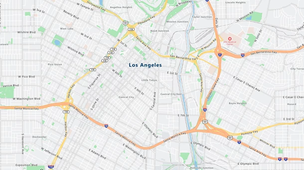
The Azure LBS Render Service is use for fetching maps. The Render Service is the basis for maps in Azure LBS and powers the visualizations in the Azure Map Control. Users can request vector-based map tiles to render data and apply styling on the client. The Render Service also provides raster maps if you want to embed a map image into a web page or application. Azure LBS maps have high fidelity geographic information for over 200 regions around the world and is available in 35 languages and two versions of neutral ground truth.
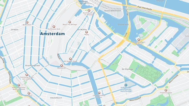
The Azure LBS cartography was designed from the ground up and created with the enterprise customer in mind. There are lower amounts of information at lower levels of delineation (zooming out) and higher fidelity information as you zoom in. The design is meant to inspire enterprise customers to render their data atop of Azure LBS Maps without additional detail bleeding through disrupting the value of customer data.
Routing Service
The Azure LBS Routing Service is used for getting directions, but not just point A to point B directions. The Azure LBS Routing Service has a slew of map data available to the routing engine allowing it to modify the calculated directions based on a variety of scenarios. First, the Routing Service provides customers the standard routing capabilities they would expect with a step-by-step itinerary. The calculation of the route can use the faster, shortest or avoiding highly congested roads or traffic incidents. For traffic-based routing, this comes in two flavors: “historic” which is great for future route planning scenarios when users would like to have a general idea of what traffic tends to look like on a given route; and, “live” which is ideal for active routing scenarios when a user is leaving now and wants to know where traffic exists and the best ways to avoid it.
Azure LBS Routing will allow for commercial vehicle routing providing alternate routes made just for trucks. The commercial vehicle routing supports parameters such as vehicle height, weight, the number of axels and hazardous material contents all to choose the best, safest and recommend roads for transporting their haul. The Routing Service provides a variety of travel modes, including walking, biking, motorcycling, taxiing or van routing.
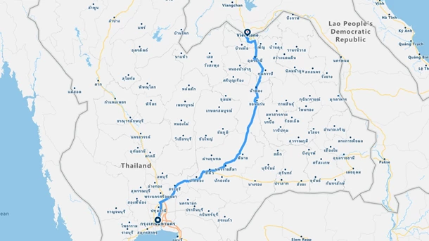
Customers can also specify up to 50 waypoints along their route if they have pre-determined stops to make. If customers are looking for the best order in which to stop along their route, they can have Azure LBS determine the best order in which to route to multiple stops by passing up to 20 waypoints into the Routing Service where an itinerary will be generated for them.
Using the Azure LBS Route Service, customers can also specify arrival times when they need to be at a specific location by a certain time. Using the massive amount of traffic data, almost a decade of probes captured per geometry and high frequency intervals Azure LBS can let customers know given day or the week and time when is the best time of departure. Additionally, Azure LBS can use current traffic conditions to notify customers of a road change that may impact their route and provide updated times and/or alternate routes.
Azure LBS can also take into considering the engine type being used. By default, Azure LBS assumes a combustion engine is being used; however, if an electrical engine is in use Azure LBS will accept input parameters for power settings and generate the most energy efficient route.
The Routing Services also allows for multiple, alternate routes to be generated in a single query. This will save on over the wire transfer. Customers can also specify that they would like to avoid specific route types such as toll roads, freeways, ferries or carpool roads.
Sample Commercial Vehicle Route Request (Key Required): atlas.microsoft.com/route/directions/json?api-version=1&query=52.50931,13.42936:52.50274,13.43872&travelMode=truck
Search Service
The Azure LBS Search Service provides the ability for customers to find real world objects and their respective location. The Search Service provides for three major functions:
- Geocoding: Finding addresses, places and landmarks
- POI Search: Finding businesses based on a location
- Reverse Geocoding: Finding addresses or cross streets based on a location
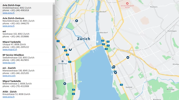
With the Search Service, customers can find addresses and places from around the world. Azure LBS supports address level geocoding in 38 regions, cascading to house numbers, street-level and city level geocoding for other regions of the world. Customers can pass addresses into the service based in a structured address form; or, they can use an unstructured form when they want to allow for their customers to search for addresses, places or business in a single query. Users can restrict their searches by region or bounding box and can query for a specific coordinate to influence the search results to improve quality. Reverse the query to provide a coordinate, say from a GPS receiver, customers can get the nearest address or cross street returned from the service.
The Azure LBS Search Service also allows customers to query for business listings. The Search Service contains hundreds of categories and hundreds of sub-categories for finding businesses or points of interest around a specific point or within a bounding area. Customers can query for businesses based on brand name or general category and filter those results based on location, bounding box or region.
Sample POI Search Request (Key Required): atlas.microsoft.com/search/poi/category/json?api-version=1&query=electric%20vehicle%20station&countrySet=FRA
Time Zone Service
The Azure LBS Time Zone Service is a first of it’s kind providing the ability to query time zones and time for locations around the world. Customers can now submit a location to Azure LBS and receive the respective time zone, the respective time in that time zone and the offset to Coordinated Universal Time (UTC). The Time Zone Service provides access to historical and future time zone information including changes for daylight savings. Additionally, customers can query for a list of all the time zones and the current version of the data – allowing customers to optimize their queries and downloads. For IoT customers, the Azure LBS Time Zone Service allows for POSIX output, so users can download information to their respective devices that only infrequently access the internet. Additionally, for Microsoft Windows users, Azure LBS can transform Windows time zone IDs to IANA time zone IDs.
Sample Time Zone Request (Key Required): atlas.microsoft.com/timezone/byCoordinates/json?api-version=1&query=32.533333333333331,-117.01666666666667
Traffic Service
The Azure LBS Traffic Service provides our customers with the ability to overlay and query traffic flow and incident information. In partnership with TomTom, Azure LBS will have access to a best in class traffic product with coverage in 55 regions around the world. The Traffic Service provides the ability to natively overlay traffic information atop of the Azure Map Control for a quick and easy means of viewing traffic issues. Additionally, customers have access to traffic incident information – real time issues happening on the road and collected through probe information on the roads. The traffic incident information provides additional detail such as the type of incident and the exact location. The Traffic Service will also provide our customers with details of incidents and flow such as the distance and time from one’s current position to the “back of the line;” and, once a user is in the traffic congestion the distance and time until they’re out of it.
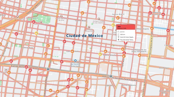
Sample Traffic Flow Segment Request (Key Required): atlas.azure-api.net/traffic/flow/segment/json?api-version=1&unit=MPH&style=absolute&zoom=10&query=52.41072,4.84239
Azure Location Based Services are available now in public preview via the Azure portal. Get your account created today.