Mobility has become the center of an array of new technologies running the gamut from cloud-based algorithms and ride-sharing services, to edge cognition, assisted driving, and traffic pattern analysis – all in an effort to move people and things from one location to another more efficiently. These are challenging initiatives that require scale, real-time intelligence, and deep insights. In an effort to begin chipping away at helping to get people moving, Azure Maps is excited to introduce Mobility service APIs for Azure Maps.
The Mobility service will begin by powering public transit routing, enabling organizations to add public transportation information and routing capabilities into their mobility, IoT, logistics, asset tracking, smart cities, and similar solutions.
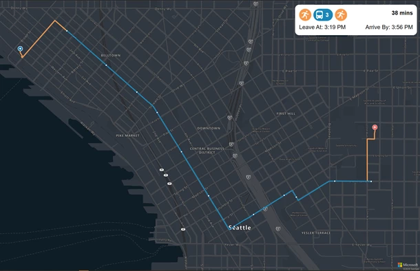
The Mobility service APIs for Azure Maps are brought to life in partnership with Moovit, Inc – a partnership that was announced last year. Natively through Azure Maps applications organizations can use transit routing to serve public transportation data to their customers, as well as to generate deeper insights, with applications spanning smart cities, transportation, automotive, field services, retail, and more.
A collection of operations allow applications to request public transit, bikeshare, scooter share, and car share information to plan their routes leveraging alternative modes of transportation and real-time data. Applications can use the information returned for smart city and IoT scenarios like:
- Minimizing urban congestion by combining public and private transportation services
- Leveraging IoT sensor data to enable dynamic routing
- Simulating the movements of occupants in city environment
The Mobility service also provides additional insights on mobility trends, such as public transit ridership, costs and benefits of different transit modes, justifications for additional public transit, or additional taxation opportunities for roads and parking.
The Mobility service provides the ability to natively request nearby transit objects such as public transit stops, shared bikes, scooters, or cars around a given location and allows users to search for specific object types within a given radius returning a set of transit objects with object details. The returned information can be used for further processing such as requesting real-time arrivals for the stop, or transit stop details such as main transit type of most lines stopping for a given public stop, active service alerts, or main transport agency. Users can request transit line details covering basic information, such as line number and group information, or more detailed information such as line geometry, list of stops, scheduled and real-time transit arrivals, and service alerts.
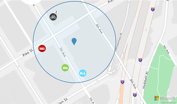
Show on map nearby transit objects around given location and within specific radius.
Customers can also find out how many available shared bikes are left in the closest dock by requesting docking stations information. While searching for available car share vehicles, details such as future availability and current fuel level are included in the response. This information can be used for further processing, such as calling the Azure Maps Route Range API to calculate a reachable range (isochrone) from the origin point based on fuel or time budget and requesting point of interests within the provided isochrone by using the Search Inside Geometry API.
The Mobility service supports trip planning, returning the best possible route options and providing a variety of travel modes, including walking, biking, and public transit available within the metro area (city). The service allows users to request one or multiple public transit types, such as bus, tram, and subway. It also allows users to focus on certain types of bikes and preferences for a specific transit agency operating in the metro area. Also, users have the option to choose optimal routes based on multiple parameters, such as minimal walking, minimal transfers, or specify desired departure or arrival times. The Mobility service support real-time trip planning and provides real-time arrival information for stops and lines. Azure Maps can send notifications to users about service alerts for stops, lines, and metro areas (city), and provide updated times with alternate routes in case of interruptions.
The Mobility service can also return multiple, alternate routes that may not be considered optimal given current condition, but could be preferred by the end user. The service returns data pertaining various legs comprising the route itinerary, including the locations, public transit lines, as well as start and end times. Users can also request transit itinerary details with additional information such geometry of the route and detailed itinerary schedules.
SDK updates
Azure Maps Web SDK
In this release we have added a preview of a new drawing tools module which makes it easy to draw points, lines, and polygons on the map using a mouse or touch. Several new spatial math features have been added around speed and acceleration-based calculations, as well as affine transformations, polygon area calculations, closest point to a line, and convex hulls. The team has also spent a lot of time adding performance enhancement, stability, and improving accessibility.
Azure Maps Android SDK update
Added support for Azure Active Directory authentication, drawing lines and polygons, and raising and handling events.
Spatial Operations for Azure Maps are now generally available
Azure Maps Spatial Operations takes location information then analyzes it on the fly to help inform customers of ongoing events happening in time and space, enabling near real-time analysis and predictive modeling of events. Spatial Operations provides applications enhanced location intelligence with a library of common geospatial mathematical calculations, including services such as closest point, great circle distance, and buffers.
Cartography and styling updates
Light grey map style
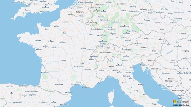
We’ve added a new map style, light grey, to our map style offering. A compliment to the dark grey style, the new light grey canvas is created for our customers to visualize their custom data atop lighter contrast map. Like the other styles, this can be used seamlessly with the Azure Maps Web SDK and Android SDK, for example, to create interactive maps with data driven styling, or heatmaps from a data set of point features.

Zoom level 4

Zoom level 15
Pedestrian and walking paths
Additional detail has been added for pedestrian and walking paths, including moving to zoom level 14, which has greatly improved the appearance of urban areas and city parks.
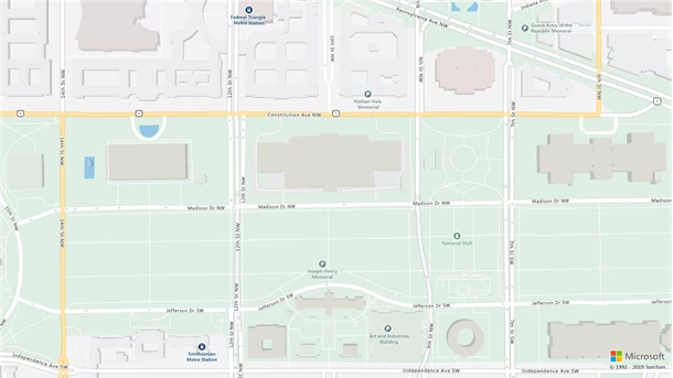
Road network layering
To give a more realistic view, we are now showing the layering of tunnels, bridges, underpasses, and overpasses for both vehicle and pedestrian crossings.
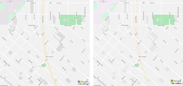
Data rendering
To improve styling and usability, certain polygons and labels were pushed up in the data so that they appear at higher levels. Hundreds of cities have been regrouped by size in the data in order to adjust which zoom level cities are showed based on significance. As a result, medium and large cities have been moved to zoom level 4. Due to symbol collision, most medium cities do not show until level 5. In addition, all national, regional, and state parks are now rendered at zoom level 4 instead of zoom level 7.
We want to hear from you!
We are always working to grow and improve the Azure Maps platform and want to hear from you. We’re here to help and want to make sure you get the most out of the Azure Maps platform.
- Have a feature request? Add it or vote up the request on our feedback site.
- Having an issue getting your code to work? Have a topic you would like us to cover on the Azure blog? Ask us on the Azure Maps forums.
- Looking for code samples or wrote a great one you want to share? Join us on GitHub.
- To learn more, read the Azure Maps documentation.
