I’m excited to announce new capabilities added to Azure Maps. We’re unveiling some highly useful features to further bolster Azure Maps to ensure our enterprise customers have everything they need geospatially as they adopt Azure. More and more geospatial workloads are moving from on-premise to the cloud, and moving from other cloud providers to the Azure cloud to take advantage of Azure’s global scale, performance, and Azure Maps’ robust set of capabilities. Check out the latest set of features now natively available in Azure Maps.
Matrix Routing
Many Azure Maps’ customers power transportation, logistics delivery, and field services systems. Matrix Routing allows customers to determine the travel time and distances from a set of origins to a set of destinations. As an example, let’s say an air conditioning company has 5 field service mechanics and each of those them start their day from home across various locations around town. The air conditioning company has 25 jobs in a day. So, who should tackle which job? Enter Route Matrix. The calculation is represented in the below table where n is the highest number of either origins or destinations, which in this case 5 origins and 25 destinations).
|
Origin |
Destination |
|
O1 |
D1 |
|
O1 |
D2 |
|
O1 |
Dn |
|
O2 |
D1 |
|
O2 |
D2 |
|
O2 |
Dn |
|
On |
Dn |
The Matrix Routing service has many more applications for pre-determining route distances and travel times, but can also be integrated as a run-time decision. For example, you may have customers with more urgent needs (i.e. an emergency situation) where you may need to deploy the right people to the location immediately. Who is the closest with the right equipment? Perhaps certain customers are willing to pay a premium to be serviced sooner rather than later. You can include this in your decision making. When news stories break, who can get to the scene fastest to report? Integrating Matrix Routing can be critical to your real-time decision making process. You can even implement Matrix Routing in a way where you don’t have to ask the service, the service can run the calculations constantly through our REST interface allowing you to wire up a notification system to tell you who should be where and when an incident occurs. Lots of powerful, geospatial scenarios via Route Matrix now available through the Azure Maps Routing Service as public preview.
Route Range
Also known as isochrones, the Route Range method is releasing as a preview in the Azure Maps Routing service allows customers to determine the distance from a single point in which a user can reach based on time. For example, if you want to determine all of the possible distances a car can reach from within 5, 10, or 15 minutes of where it is located, the Route Range method can provide that. These are great for transportation scenarios where time is the main constraint. Azure Maps’ Route Range goes beyond just time-based isochrone calculations. Route Range also allows you to input energy as a determination of reachable range, meaning if you have a combustion engine you can specify how much fuel you have remaining along with the consumption budget to determine how far a user can get from a location based on fuel. Azure Maps also has the ability to specify the same types of energy consumption budget for electric vehicles. You can specify the electric engine type and pass in the kilowatt hours budget to determine how far an electric vehicle can go.
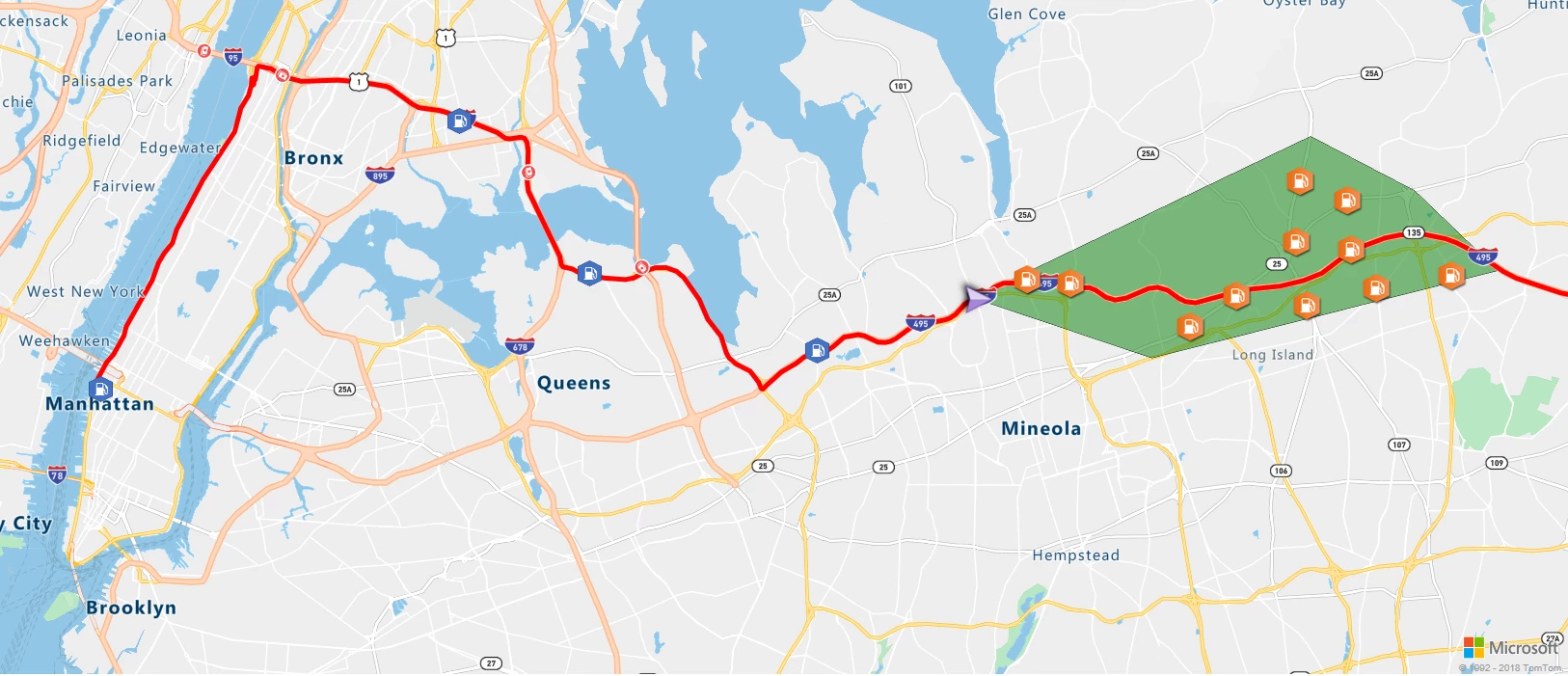
You can use Route Range in isolation to determine how far users can get, but even more interesting is applying it to other Azure Maps services. For example, the output for Route Range is technically a polygon. The polygon can then be used in conjunction with the Azure Maps Search service for filtering (geometrically) search results for certain points of interest like gas stations, charging stations, restaurants, and hotels. With the combination of these services, you’ll be able to improve your driving experience with better assurances.
Batch geocoding service
Adding batch capabilities to the Azure Maps Search service as a preview allows for customers to post bulk addresses for geocoding or finding business locations. This works for both forward and reverse geocoding. Consider you have 5,000 addresses for which you need coordinates. You can post those 5,000 addresses in a single request to Azure Maps batch geocoding service to get the coordinates returned back in line with the returned endpoint. Batch services offloads the need to call the Azure Maps Search Service 5,000 times at run time when you need to see them on a map. From there you can easily render as many, or as few, of these points onto the map. You can also feed the resulting coordinates into the Azure Maps Route Service for route calculations. The impetus for batching addresses is to take the workload off the front end services and allow you to use geometric/spatial calculations against that data set without having to call the service every time you want to know the coordinate of a location. Getting all of the coordinates upfront allows you to optimize your applications for performance.
Batch routing service
Similar to batch geocoding, batch routing now as a preview part of the Azure Maps Routing service is super useful when you’re planning many routes ahead of time. Customers can post a list of origins and destinations to the batch route service to return the estimated time and distance to and from each respective origin and destination. The best part is all of our routing parameters are included in the batch capabilities! You can batch commercial vehicle routes. You can batch historical traffic-based routes, used in conjunction with predictive routing. You can batch optimized routes. For example, given 10 stops in a day, what is the best order in which to optimize the route on those stops? This service is great for customers looking to offload daily route processing and get the benefit of Azure Maps’ weekly map updates, a decade of historical traffic information, and real-time traffic information all in batch.
New map styles
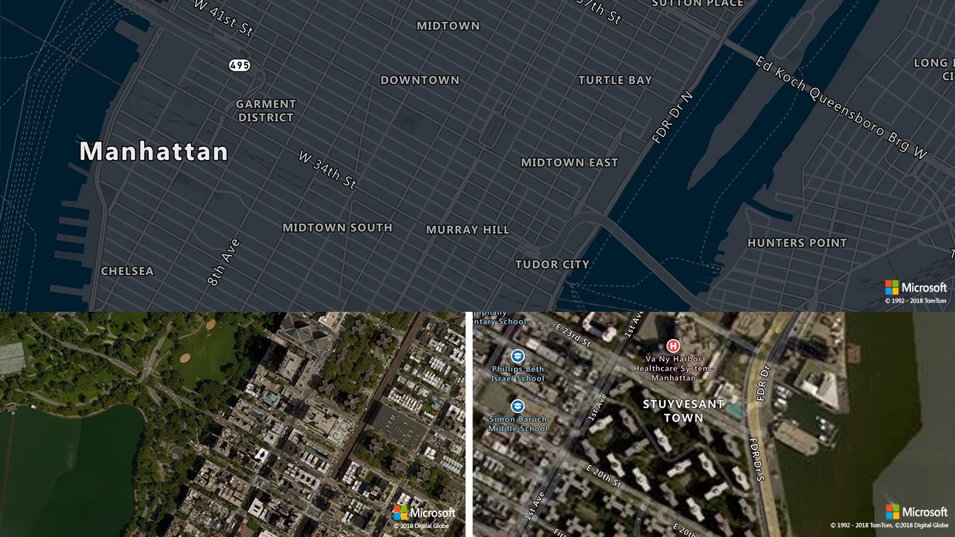
With this release we’re introducing a few new map canvases to Azure Maps, specifically (1) dark gray, (2) satellite (Nadir) imagery, and (3) satellite + roads and labels style. The dark gray is intended to give deeper contrast for overlaying customer data atop the map to really make it stand out. We’ve also added satellite imagery to Azure Maps providing customers with visible, physical location through actual photos of the Earth. We’re also using Azure Maps’ roads and labels atop the imagery to provide additional context in the case that customers need help getting their bearings when navigating satellite imagery. The best part is that these map styles work seamlessly with the Azure Map Control, so customers can create interactive capabilities such as click to add pins, draw lines, polygons, layer vector, or raster data. Everything that is currently available in our client-side JS SDK is now available with these map styles.
Map control modules: controls and services
We’re making it easier for developers to build Azure Maps’ capabilities into their applications more quickly. We’re introducing two new extensions to the Azure Map Control, controls and services. The controls module allows developers to easily add pan, zoom, tile, and map style selection capabilities. The services module makes it easier to natively connect to Azure Maps REST Services by adding a library to the JavaScript SDK and having all of the endpoints and methods available to code against. This is a step up from having to wrap the services in JavaScript yourself – direct customer feedback we’ve received and implemented for developers.
|
Function |
User experience |
|
Base control with modularized components: From top to bottom – Tilt, change map style, zoom in, zoom out, and rotate canvas |
 |
| Tilt Component: Tilt the map canvas, either down to raise the horizon or up to lower the horizon. | 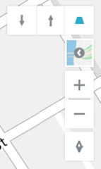 |
| Map style selector: Choose the map style you’d like to use. Current selections include Road, Satellite, Satellite with Roads and Labels, or Dark Gray. | 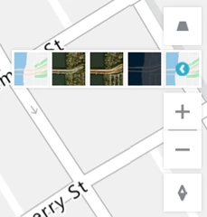 |
| Rotate: Rotate the canvas to view Azure Maps and custom data overlays from different perspectives. |  |
Return polygons for area features
Azure Maps is introducing the ability to highlight certain features on the map by making base map polygons and administrative districts query-able. Using the Azure Maps Search service, customers will be able to preview the ability to search for polygonal areas such as “King County” {Washington State} which returns an identifier for the county. The identifier can then be used for querying the shape of King County. Once the polygon is returned, customers can send the polygon to the Azure Map Control as a vector for rendering. Rendering multiple polygons on the map, especially administrative shapes, allows for thematic mapping.
In a retail example, if you wanted to highlight regional store sales by county in Washington state, you’ll be able to fetch the shapes of the various counties and color them by profit and loss metrics. There are a slew of map data visualization scenarios we can apply by opening up these polygons! Additionally, since these are polygons, they can be applied to the Azure Maps Search Service to filter point of interest searches by administrative district. For example, you may want to query all of the gas stations in San Diego County, California, query all of the charging stations within the boundaries of Paris, France, or search for hotels only within Luxembourg. Granting access to the feature area polygons to be used in conjunction with Azure Maps services can be a very powerful tool for things like government funding, regional taxation, and voting visualizations. This list goes on and on…
IP to Location service
Internet protocols (IP) are mapped to countries/regions. There are many times when as an enterprise company, you’d like to know from where a user is calling you in order to provide personalization, security, and/or restrictions. The Azure Maps IP to Location service allows customers to use end user Internet protocol numbers determine from which country/region the user is calling. This will help in scenarios where you would like to center the map on a specific region, set the map experience to a certain language, or limit users in certain regions to a limited experience (perhaps your company isn’t licensed to do business in a particular area). The Azure Maps IP to Location service will allow you to provide users with a better experience once they land on your applications using Azure Maps!